


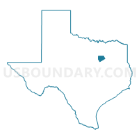
Ellis County PUMA, Texas
About
Outline

Summary
| Unique Area Identifier | 194102 |
| Name | Ellis County PUMA |
| State | Texas |
| Area (square miles) | 951.75 |
| Land Area (square miles) | 935.49 |
| Water Area (square miles) | 16.26 |
| % of Land Area | 98.29 |
| % of Water Area | 1.71 |
| Latitude of the Internal Point | 32.34727890 |
| Longtitude of the Internal Point | -96.79833570 |
Maps

Graphs
Select a template below for downloading or customizing gragh for Ellis County PUMA, Texas


Neighbors
Neighoring Public Use Microdata Area (by Name) Neighboring Public Use Microdata Area on the Map
- Dallas County (South)--DeSoto & Lancaster Cities PUMA, TX
- Dallas County (Southeast)--Dallas City (Southeast) PUMA, TX
- Dallas County (Southwest)--Cedar Hill & Duncanville Cities PUMA, TX
- East Texas COG (Southwest)--Henderson & Anderson Counties PUMA, TX
- Heart of Texas COG (Outside McLennan County) & Navarro County PUMA, TX
- Johnson County PUMA, TX
- Kaufman County PUMA, TX
- Tarrant County (Southeast)--Mansfield (North) & Arlington (Southwest) Cities PUMA, TX
Top 10 Neighboring County (by Population) Neighboring County on the Map
- Dallas County, TX (2,368,139)
- Tarrant County, TX (1,809,034)
- Johnson County, TX (150,934)
- Ellis County, TX (149,610)
- Kaufman County, TX (103,350)
- Henderson County, TX (78,532)
- Navarro County, TX (47,735)
- Hill County, TX (35,089)
Top 10 Neighboring County Subdivision (by Population) Neighboring County Subdivision on the Map
- Northeast Dallas CCD, Dallas County, TX (1,455,973)
- Southwest Dallas CCD, Dallas County, TX (912,166)
- Arlington CCD, Tarrant County, TX (491,713)
- Waxahachie CCD, Ellis County, TX (77,362)
- Alvarado CCD, Johnson County, TX (40,488)
- Cedar Creek Lake CCD, Henderson County, TX (35,484)
- Corsicana CCD, Navarro County, TX (32,710)
- Ennis CCD, Ellis County, TX (26,030)
- Midlothian CCD, Ellis County, TX (21,246)
- Kaufman CCD, Kaufman County, TX (14,815)
Top 10 Neighboring Place (by Population) Neighboring Place on the Map
- Grand Prairie city, TX (175,396)
- Mansfield city, TX (56,368)
- Cedar Hill city, TX (45,028)
- Lancaster city, TX (36,361)
- Waxahachie city, TX (29,621)
- Ennis city, TX (18,513)
- Midlothian city, TX (18,037)
- Glenn Heights city, TX (11,278)
- Red Oak city, TX (10,769)
- Ovilla city, TX (3,492)
Top 10 Neighboring Unified School District (by Population) Neighboring Unified School District on the Map
- Dallas Independent School District, TX (1,020,846)
- Mansfield Independent School District, TX (138,558)
- DeSoto Independent School District, TX (52,891)
- Cedar Hill Independent School District, TX (45,362)
- Waxahachie Independent School District, TX (41,128)
- Lancaster Independent School District, TX (36,347)
- Midlothian Independent School District, TX (32,577)
- Ennis Independent School District, TX (26,542)
- Red Oak Independent School District, TX (25,231)
- Crandall Independent School District, TX (11,978)
Top 10 Neighboring State Legislative District Lower Chamber (by Population) Neighboring State Legislative District Lower Chamber on the Map
- State House District 10, TX (184,699)
- State House District 4, TX (181,882)
- State House District 93, TX (179,024)
- State House District 109, TX (175,255)
- State House District 58, TX (169,146)
- State House District 106, TX (159,716)
- State House District 110, TX (150,703)
- State House District 8, TX (149,393)
Top 10 Neighboring State Legislative District Upper Chamber (by Population) Neighboring State Legislative District Upper Chamber on the Map
- State Senate District 2, TX (856,525)
- State Senate District 10, TX (834,265)
- State Senate District 3, TX (818,359)
- State Senate District 9, TX (807,907)
- State Senate District 22, TX (789,412)
Top 10 Neighboring 111th Congressional District (by Population) Neighboring 111th Congressional District on the Map
- Congressional District 6, TX (809,095)
- Congressional District 24, TX (792,319)
- Congressional District 17, TX (760,042)
- Congressional District 5, TX (725,642)
- Congressional District 30, TX (706,469)
Top 10 Neighboring Census Tract (by Population) Neighboring Census Tract on the Map
- Census Tract 508, Kaufman County, TX (9,307)
- Census Tract 170.01, Dallas County, TX (9,090)
- Census Tract 602.04, Ellis County, TX (8,596)
- Census Tract 606, Ellis County, TX (8,268)
- Census Tract 513, Kaufman County, TX (8,215)
- Census Tract 1304.07, Johnson County, TX (7,992)
- Census Tract 601.01, Ellis County, TX (7,626)
- Census Tract 614, Ellis County, TX (7,595)
- Census Tract 9703, Navarro County, TX (7,564)
- Census Tract 1304.08, Johnson County, TX (7,296)
Top 10 Neighboring 5-Digit ZIP Code Tabulation Area (by Population) Neighboring 5-Digit ZIP Code Tabulation Area on the Map
- 76063, TX (61,361)
- 75104, TX (45,373)
- 75165, TX (37,966)
- 75154, TX (36,041)
- 76065, TX (28,986)
- 75110, TX (28,132)
- 75119, TX (26,601)
- 76009, TX (19,759)
- 75159, TX (18,339)
- 75146, TX (17,993)